Stereophotoclinometry
Stereophotoclinometry is a technique used to generate ultra-high resolution digital elevation models (DEM) from images. This is typically used in NASA spacecraft missions to asteroids and comets. It has also been used for making DEMs of the Moon and the Earth.
It was created by Dr. Robert Gaskell who works at the Planetary Science Institute.
The Planetary Science Institute maintains and distributes the software for Stereophotoclinometry in both binary and source code, https://spc.psi.edu. The software has a US Commodity Classification of EAR99 and is available for scientific and commercial use. Previous restrictions under U.S. International Traffic in Arms Regulation (ITAR) do not apply.
Please contact Eric Palmer ([email protected]) for licensing and use information. The SPC User’s Manual is provided publicly for all to use, but provides no warrantees on the details of the documentation.
Wiki Link: https://spc.psi.edu/spc_wiki/
.

.
Contacts:
Dr. Eric Palmer – [email protected]
Dr Gaskell – [email protected]
Dr. John Weirich – [email protected]
.
.
.
.
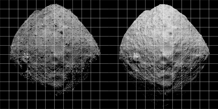
Mathilde

Topography of the lunar poles, constructed using stereophotoclinometry (SPC) and Clementine images, is compared with results from LOLA and LRO wide-angle camera analyses.
Publications
Digital Terrain Models of Mathilde and the Moon
Reference Citation: Weirich, J.~R., Palmer, E.~E., Domingue, D.~L.\ 2019.\ Digital Terrain Models of Mathilde and the Moon.\ Lunar and Planetary Science Conference 2681.
Abstracts
https://ui.adsabs.harvard.edu/abs/2011LPI….42.2535G/abstract 50th Lunar and Planetary Science Conference, held 18-22 March, 2019 at The Woodlands, Texas. LPI Contribution No. 2132, id.2681
.
The Moon
Topography of the lunar poles, constructed using stereophotoclinometry (SPC) and Clementine images, is compared with results from LOLA and LRO wide-angle camera analyses.
Publications
Digital Terrain Models of Mathilde and the Moon
Reference Citation: Weirich, J.~R., Palmer, E.~E., Domingue, D.~L.\ 2019.\ Digital Terrain Models of Mathilde and the Moon.\ Lunar and Planetary Science Conference 2681.
Abstracts
https://ui.adsabs.harvard.edu/abs/2011LPI….42.2535G/abstract 50th Lunar and Planetary Science Conference, held 18-22 March, 2019 at The Woodlands, Texas. LPI Contribution No. 2132, id.2681
.
.
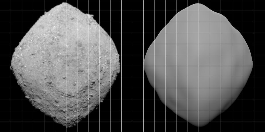
Ryugu
This SPC model was generated during the JAXA Hayabusa 2 mission.
Data: https://www.darts.isas.jaxa.jp/pub/hayabusa2/paper/Watanabe_2019/README.html
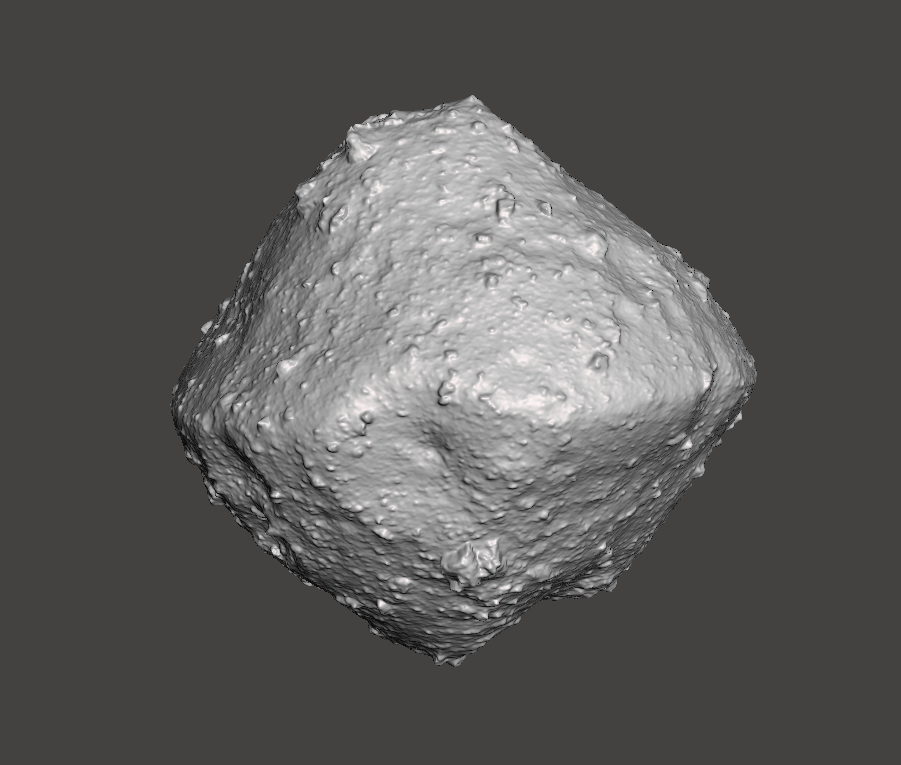
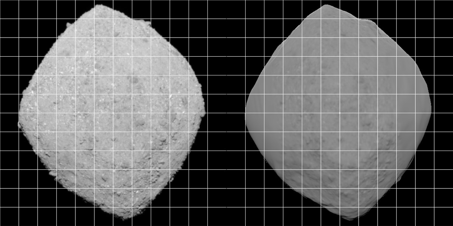
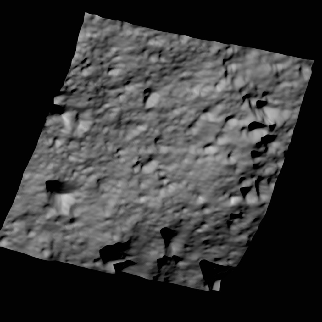
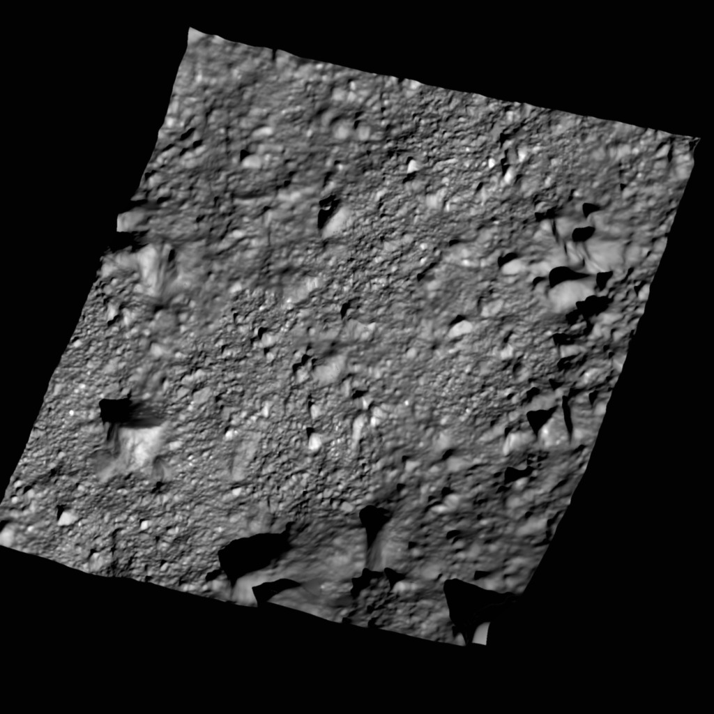
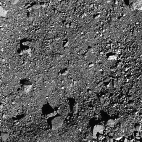
Bennu
OSIRIS REx NASA Mission
The accuracy of the global digital terrain model (GDTM) of Bennu obtained by the OSIRIS-REx mission to date has achieved global requirements earlier than anticipated. Additionally, a comparison between real images and synthetic images derived from the GDTM using normalized cross correlation show an exceptionally good match.
Data
101955 Bennu Shape Model PDS SBN OSIRIS-REx SPICE Data Archive
Publications:
Image Cross Correlation as a Measurement of Shape Model Quality
Reference Citation: Palmer, E.~E., Weirich, J.~R., Campbell, T., Barnouin, O.~S., Daly, M.~G., Lauretta, D.~S.\ 2018.\ Image Cross Correlation as a Measurement of Shape Model Quality.\ Lunar and Planetary Science Conference 1106.
Stereophotoclinometry Models in Support of the OSIRIS-REx Mission .
Reference Citation: Palmer, E.~E., and 11 colleagues 2019.\ Stereophotoclinometry Models in Support of the OSIRIS-REx Mission.\ Lunar and Planetary Science Conference 2588.
Evaluation of the Bennu Global Digital Terrain Model for OSIRIS-REx
Reference Citation: Palmer, E., and 7 colleagues 2019.\ Evaluation of the Bennu Global Digital Terrain Model for OSIRIS-REx.\ EPSC-DPS Joint Meeting 2019 2019, EPSC-DPS2019-387.
Abstracts:
Evaluation of the Bennu Global Digital Terrain Model for OSIRIS-REx EPSC AbstractsVol. 13, EPSC-DPS2019-387-1, 2019 EPSC-DPS Joint Meeting 2019
Stereophotoclinometry Models in Support of the OSIRIS-REx Mission 50th Lunar and Planetary Science Conference 2019 (LPI Contrib. No. 2132)
Image Cross Correlation as a Measurement of Shape Model Quality 49th Lunar and Planetary Science Conference 19-23 March, 2018, held at The Woodlands, Texas LPI Contribution No. 2083, id.1106
Evaluation of Topographic Error and Quality with Stereophotoclinometry 49th Lunar and Planetary Science Conference 2018 (LPI Contrib. No. 2083)
Error Analysis of Stereophotoclinometry in Support of the OSIRIS-REx Mission American Astronomical Society, DPS meeting #47, id.213.17
.
.
A progression of the SPC process throughout the OSRIS-REx mission
2013 Nolan Model

12 November Early Limb-based model
22 November Early SPC model
2nd December – End of approach
End of PreSurvey Model
.

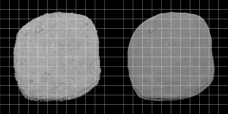
Ceres

Data
Ceres Shape model SBN PDS 2018
.
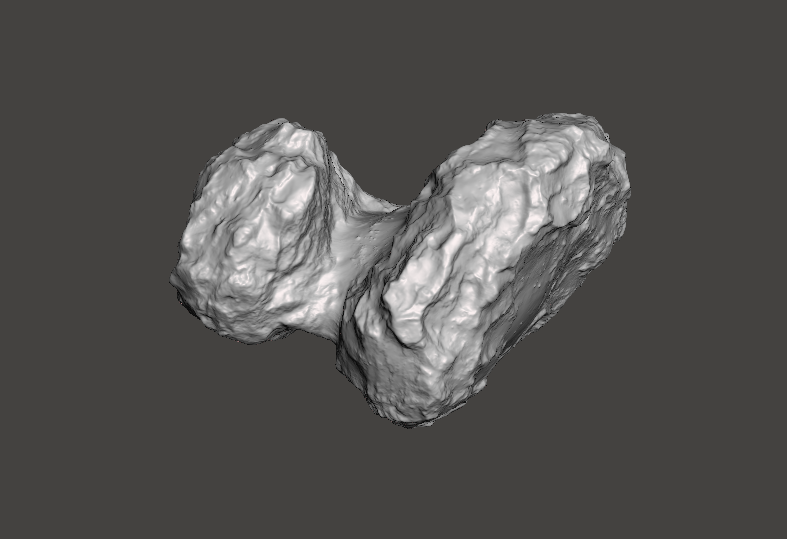
67P/Churyumov–Gerasimenko

During the last weeks of July, the ROSETTA spacecraft made its final approach to comet 67P/Churyumov-Gerasimenko, revealing a two lobed object that would be a challenge to model. The first real rotation “movies”, taken between August 1 and 4 and another set from August 8 allowed a group working at the Laboratoire d’Astrophysique de Marseille (LAM), to construct a first crude full-resolution shape model, building on earlier work on approach images also performed at LAM. During the next weeks and months, higher and higher resolution images became available at a variety of illuminations and viewing geometries, allowing the refinement of the shape and the construction of surface topography to sub-meter scale. We present a potpourri of preliminary results from this most intriguing object.
Data
Gaskell 2014 67P/Churyumov–Gerasimenko shape model data SBN PDS data archive
Publications
Comet 67P/CG: Preliminary Shape and Topography from SPC
Reference Citation: Gaskell, R.~W., and 6 colleagues 2014.\ Comet 67P/CG: Preliminary Shape and Topography from SPC.\ AAS/Division for Planetary Sciences Meeting Abstracts #46 209.04.
Abstracts
Comet 67P/CG: Preliminary Shape and Topography from SPC American Astronomical Society, DPS meeting #46, id.209.04
.
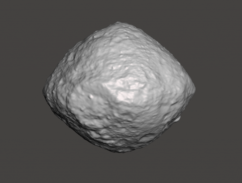
Tethys

September 2013
The shape model of Tethys derived by Robert Gaskell from Cassini Imaging Science Subsystem narrow and wide angle camera (ISSNA and ISSWA) images. The model is provided in the implicitly connected quadrilateral (ICQ) format. This version of the model was prepared on July 25, 2012.
Data
Gaskell Tethys shape Model PDS SBN data archive. September 2013
Publications
Gaskell Tethys Shape Model V1.0
Reference Citation: Gaskell, R.~W.\ 2013.\ Gaskell Tethys Shape Model V1.0.\ NASA Planetary Data System CO-SA-ISSNA-5-TETHYSSHAPE-V1.0.
Abstracts
PDS Gaskell Tethys Shape Model V1.0 NASA Planetary Data System, id. CO-SA-ISSNA-5-TETHYSSHAPE-V1.0Paragraph
.